
 EN
EN
- Description

Is there a problem?
Please contact us to serve you!

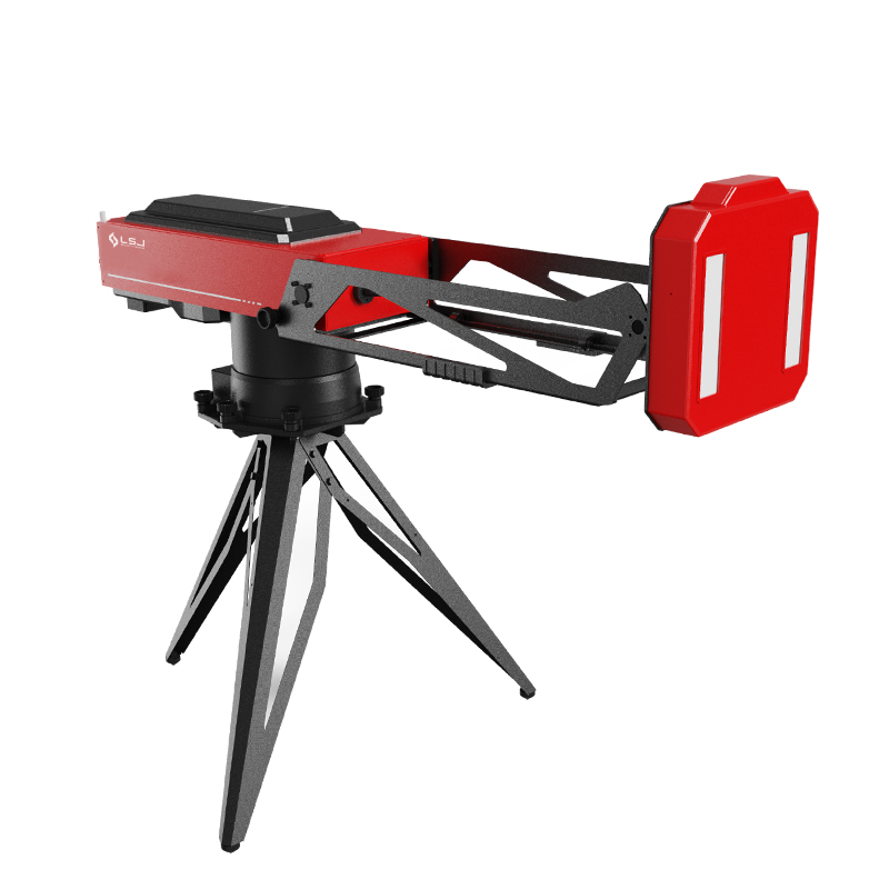

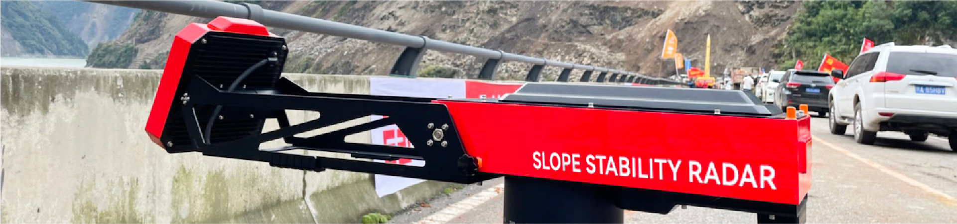
Slope Stability Radar HXSAR-5KS
360° ArcSAR Land Movement Monitoring System · 5 km Range · Sub-mm Accuracy · 8 kg · 2-Min Deployment
|
360°
COVERAGE
|
5 km
RANGE
|
Sub-mm
ACCURACY
|
|
8 kg
WEIGHT
|
<2 min
SETUP
|
−40~55°C
RATED TEMP
|
- Description
- Parameter
- Recommended Products
Description
Landslides Give Seconds. Manual Monitoring Gives Hours.
Quick answer: Conventional slope monitoring is too slow for the first critical hours after a disaster: rail-based GB-SAR takes a crew half a day to install and watches only one slope face at a time, while rain, fog, night and vegetation blind optical systems.
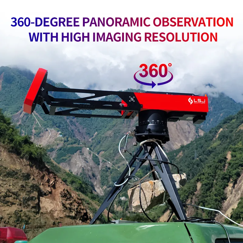
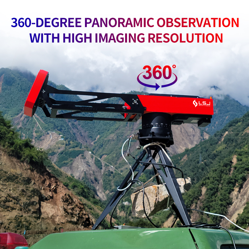
Rotating ArcSAR architecture delivers full 360-degree coverage from a single set-up point.
One 8 kg Radar. Full 360° Coverage. First Scan in Two Minutes.
Quick answer: The HXSAR-5KS is an 8 kg portable ArcSAR slope stability radar that delivers full 360-degree coverage, sub-millimeter accuracy and a 5 km range, with one-person deployment from case to first scan in under two minutes.
| HXSAR-5KS AT A GLANCE — KEY FACTS FOR SPECIFICATION | |
|---|---|
| Brand / Manufacturer | LSJ |
| Model | HXSAR-5KS |
| Product type | Portable ground-based ArcSAR (GB-SAR) slope stability radar |
| Azimuth coverage | 360° panoramic from one set-up point |
| Vertical coverage | Up to ±45° (electrical tilt −30° to +30° plus 30° antenna beam) |
| Maximum monitoring range | 5 km |
| Deformation accuracy | Sub-millimeter |
| Weight / deployment | 8 kg / under 2 minutes, one person |
| Operating temperature | −40°C to +55°C, all-weather |
| Software | ASSR-Lite — B/S architecture; Windows / Linux; Chrome, Edge, Firefox |
| Early warning | Yellow / orange / red thresholds with automatic SMS push |
| Certifications | CE (LVD & EMC), ISO, MSDS, RoHS |
| Latest field deployment | February 8, 2025 — Junlian, Sichuan, China |
The HXSAR-5KS replaces the heavy linear rail of traditional GB-SAR with a rotating ArcSAR base — collapsing laboratory-grade deformation monitoring into a man-portable, rapid-deployment instrument built for emergency response.
|
01
Carry
An 8 kg single-person portable unit in a folding case under 0.8 m long — it travels in a rescue vehicle, pickup or helicopter.
|
02
Place
Set up on a tripod at a safe vantage point up to 5 km from the slope. No rails, no prisms and no access onto unstable ground.
|
|
03
Align
The built-in GNSS satellite compass finds north automatically, while the inclinometer and attitude sensors level the unit.
|
04
Monitor
First scan in under two minutes; sub-millimeter deformation streams to a rugged tablet, laptop or the cloud.
|
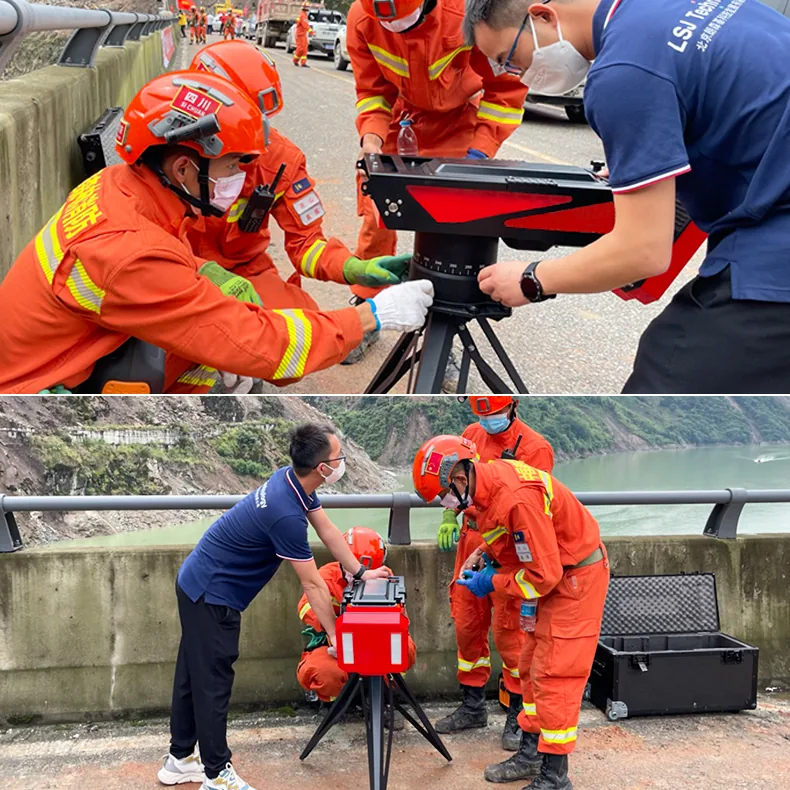
One operator, one folding case, under two minutes from arrival to first scan.
Eight Reasons the HXSAR-5KS Rewrites Slope Monitoring
Quick answer: Eight capabilities define the HXSAR-5KS: 360-degree ArcSAR coverage, sub-millimeter precision at 5 km, non-contact safety, all-weather operation from −40°C to +55°C, immunity to on-slope traffic, 8 kg two-minute set-up, automatic north-finding and unattended SMS early warning.
|
■ True 360° ArcSAR coverage
Rotating circular synthetic aperture technology replaces the linear rail, giving full azimuth coverage from one position and up to ±45° vertical coverage.
|
■ Sub-millimeter precision at 5 km
FMCW microwave radar resolves cumulative displacement, velocity and acceleration at ranges up to 5 kilometers.
|
|
■ Non-contact and personnel-safe
No prisms, sensors or cabling on the slope — operators never need to expose themselves to unstable ground.
|
■ All-weather, day and night
Penetrates rain, snow, fog, dust, glare and darkness; rated from −40°C to +55°C and capable of imaging through vegetation.
|
|
■ Immune to on-slope movement
Personnel, haul trucks and operating machinery moving across the face do not corrupt the deformation measurements.
|
■ 8 kg, two-minute deployment
One person moves the radar from its folding case to first scan in under two minutes — no crane, no crew, no rail assembly.
|
|
■ Automatic north-finding
An integrated GNSS compass, inclinometer and attitude sensor remove the survey team from the set-up process.
|
■ Unattended early warning
The browser-based ASSR-Lite platform applies yellow/orange/red thresholds, performs extreme-value detection and pushes SMS alarms automatically.
|
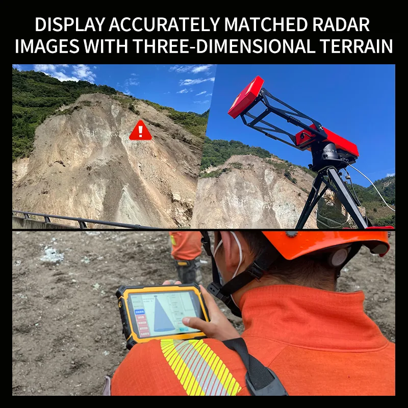
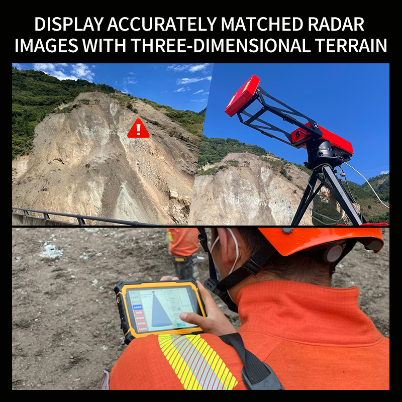
ASSR-Lite: 3D DEM matching, deformation maps and displacement curves in one browser interface.
Yellow, orange and red thresholds trigger SMS alarms on ruggedized field devices.
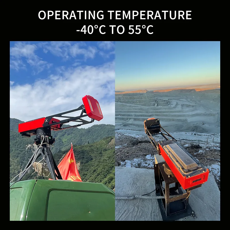
Field-proven from −40°C winters to +55°C open-pit summers.
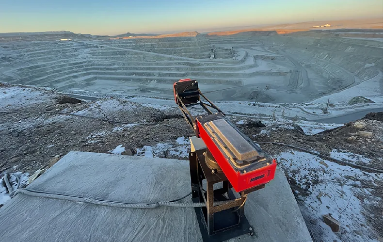
Long-term, unattended monitoring of open-pit highwalls, waste dumps and tailings dams.
Built for Every Slope That Cannot Afford to Fail
Quick answer: The HXSAR-5KS serves eight slope-monitoring scenarios: post-earthquake landslide rescue, open-pit mines and quarries, tailings storage facilities, reservoir dams, highway and railway cut slopes, construction excavations, municipal geohazard networks and geotechnical research.
|
▸ Landslide & post-earthquake emergency rescue
Rapid deployment for secondary-landslide warning in disaster zones.
|
▸ Open-pit mines & quarries
Highwall, waste dump and bench deformation monitoring without halting production.
|
|
▸ Tailings storage facilities (TSF)
Continuous dam-body displacement and saturation-zone tracking.
|
▸ Reservoir dams & hydropower
Slope and abutment monitoring through flood seasons and impoundment.
|
|
▸ Highway & railway cut slopes
Corridor-wide coverage of rock slopes along transport infrastructure.
|
▸ Construction sites & deep excavations
Foundation pits, retaining walls and temporary works protection.
|
|
▸ Municipal geohazard monitoring
Long-term networks over urban back-slopes and dangerous rock masses.
|
▸ Research & geotechnical surveys
High-density deformation data for institutes and monitoring integrators.
|
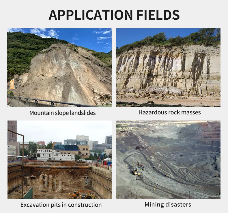
Eight application fields across emergency response, mining, dams and infrastructure.
Deployed When the Ground Was Already Moving
Quick answer: From 2022 to 2025, LSJ HXSAR-5KS radars supported four major emergency responses across Sichuan, Yunnan and Gansu, including a documented early warning before a secondary landslide in Zhenxiong, Yunnan, reported by CCTV-13 and Xinhua News Agency.
|
Feb 8, 2025 · Junlian, Sichuan
Deployed in support of the China Anneng Chengdu Base for round-the-clock monitoring after a major landslide.
|
Jan 23–26, 2024 · Zhenxiong, Yunnan
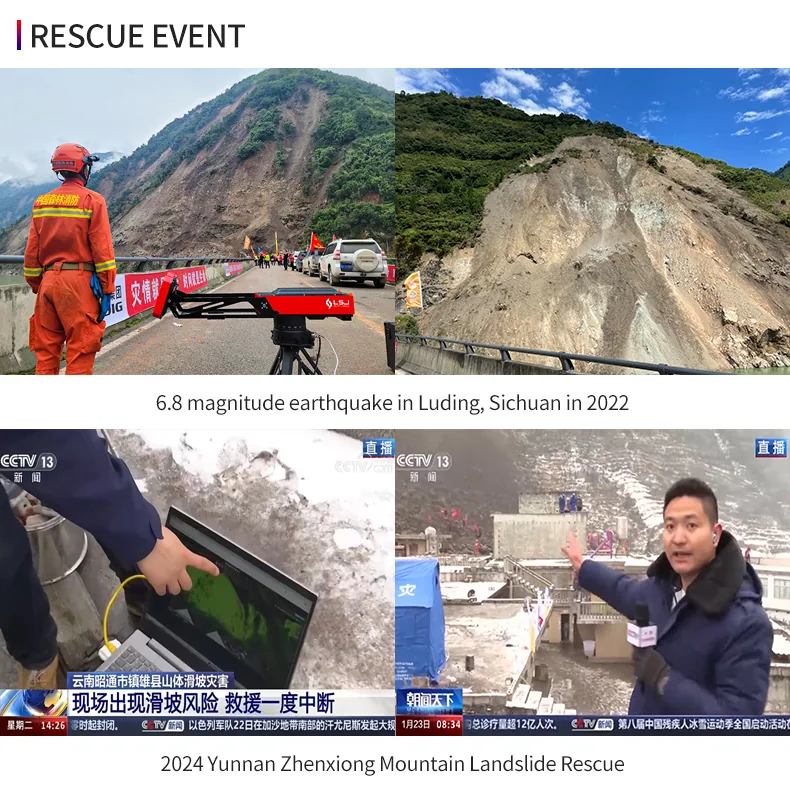
Successfully raised the alarm ahead of a secondary landslide; the operation was reported by CCTV-13 and Xinhua News Agency.
|
|
Dec 18–19, 2023 · Jishishan, Gansu
Continuous slope monitoring in the disaster area following the M6.2 earthquake.
|
Sep 5–6, 2022 · Luding, Sichuan
Emergency deployment immediately after the M6.8 earthquake to guard rescue teams against after-slides.
|
The Zhenxiong secondary-landslide warning was covered by CCTV-13 and Xinhua News Agency.
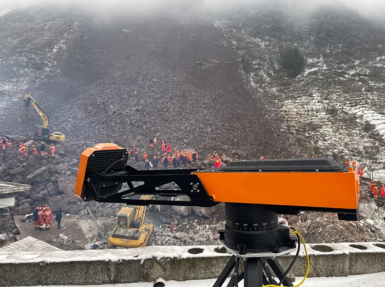
Round-the-clock monitoring in winter disaster zones — weather does not pause the radar.
Certified, Manufactured and Shown Worldwide
Quick answer: Every HXSAR-5KS ships with CE (LVD and EMC), ISO, MSDS and RoHS documentation, is built in LSJ’s in-house ground-based radar factory, and was exhibited worldwide in 2024 at INTERSEC Dubai, SECURIKA Russia, DSA/NATSEC and MITEC Malaysia, and NFPA USA.
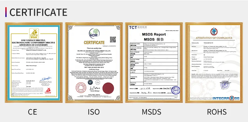
CE · ISO · MSDS · RoHS
|
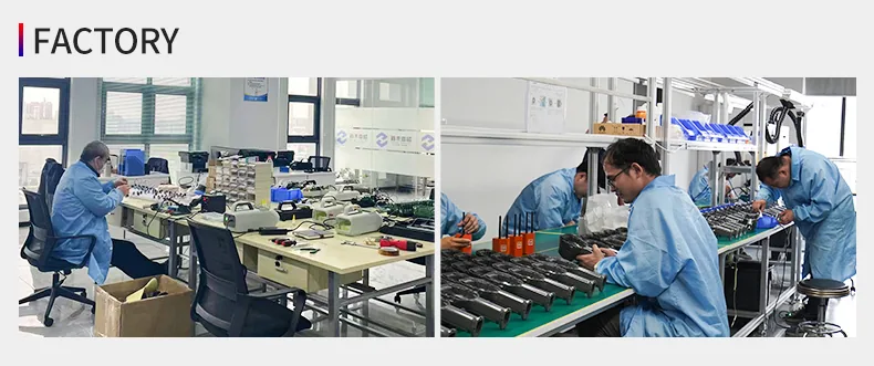
LSJ in-house manufacturing
|

INTERSEC · SECURIKA · MITEC · NFPA
|
Frequently Asked Questions
Quick answer: Below are direct answers to the questions procurement teams, geotechnical engineers and rescue commanders ask most often about the HXSAR-5KS portable slope stability radar, including accuracy, deployment, weather resistance, software and certifications.
Q: What is a slope stability radar?
A: A slope stability radar is a ground-based radar that continuously measures surface deformation of slopes, mine walls and dams without contacting them, and raises alarms when movement accelerates toward failure. The HXSAR-5KS is a portable ArcSAR-type slope stability radar made by LSJ.
Q: How is the HXSAR-5KS different from conventional GB-SAR?
A: It uses rotating ArcSAR architecture instead of a linear track, giving 360-degree coverage from one position in an 8 kg package that deploys in under two minutes; conventional rail-based GB-SAR weighs far more, requires assembly and covers only one facing.
Q: How accurate is it, and how far can it monitor?
A: The HXSAR-5KS delivers sub-millimeter deformation accuracy at ranges up to 5 kilometers across a full 360-degree azimuth, measuring cumulative displacement, velocity, acceleration and crack development.
Q: Can it operate in rain, snow or fog?
A: Yes. FMCW microwave imaging is unaffected by rain, snow, fog, dust, glare or darkness, penetrates vegetation, and the unit is rated for operation from −40°C to +55°C, day and night.
Q: How fast can it be deployed in an emergency?
A: One person can move the HXSAR-5KS from its folding case to first scan in under two minutes; the built-in GNSS satellite compass aligns north automatically and the inclinometer levels the unit, so no survey crew is needed.
Q: How does the early-warning system work?
A: Operators set yellow, orange and red displacement and velocity thresholds in the ASSR-Lite software; the platform performs unattended extreme-value detection and pushes SMS alarms automatically, and generates daily and weekly reports.
Q: Can the software run on a local network without internet?
A: Yes. ASSR-Lite uses a browser/server (B/S) architecture and can be deployed locally or in the cloud, runs on Windows and Linux, and supports Chrome, Edge and Firefox; a network connection above 20 Mbps is recommended for smooth remote viewing.
Q: Who manufactures the HXSAR-5KS, and what certifications does it carry?
A: The HXSAR-5KS is manufactured by LSJ at an in-house ground-based radar production facility. Each unit ships with CE (LVD & EMC), ISO, MSDS and RoHS documentation; in 2024 it was exhibited at INTERSEC Dubai, SECURIKA Russia, DSA/NATSEC & MITEC Malaysia and NFPA USA.
|
Know the Risk Before the Ground Moves
Tell us your slope, range and monitoring cycle — LSJ engineers will configure the HXSAR-5KS and deliver a quotation within 24 hours.
|
| HXSAR-5KS — Technical Parameters | |
|---|---|
| Radar Performance | |
| Radar Technology | ArcSAR (Arc Synthetic Aperture Radar) on a rotating base, combined with FMCW radar |
| Azimuth Coverage | 360° panoramic scan — no blind spots, no linear track required |
| Vertical Coverage | ±45° (powered tilt −30° to +30° combined with a 30° antenna beam) |
| Maximum Monitoring Range | Up to 5 km |
| Deformation Accuracy | Sub-millimeter level |
| Measured Outputs | Cumulative displacement, deformation velocity, acceleration and crack development |
| Environmental | |
| Operating Temperature | −40°C to +55°C |
| Weather Immunity | Unaffected by rain, snow, fog, dust, glare or darkness; penetrates vegetation cover |
| On-Slope Interference Immunity | Unaffected by vehicles, personnel or moving equipment within the scene |
| Physical & Mechanical | |
| Weight | 8 kg complete system — one-person carry |
| Transport | Folding transport case no larger than 0.8 m |
| Deployment Time | Under 2 minutes from case to first scan |
| Positioning, Power & Communication | |
| Built-In Positioning | GNSS satellite compass, inclinometer and attitude sensors; automatic north alignment — no surveying crew needed |
| Software (ASSR-Lite) | |
| Architecture | B/S architecture; Windows & Linux; Chrome, Edge and Firefox; local or cloud deployment |
| Visualization | 3D DEM matching, large-scene 3D rendering, slope-direction projection; intensity, deformation and noise-filtered maps |
| Analysis Tools | Displacement / velocity / acceleration curves; multi-point time-series analysis |
| Early Warning | Configurable yellow / orange / red thresholds, SMS alerts, unattended extreme-value detection |
| Reporting & Access | One-click daily and weekly reports; role-based user permissions |
| Recommended Network | Above 20 Mbps |
| Compliance & Purchase | |
| Certifications | CE (LVD & EMC), ISO, MSDS, RoHS |
| MOQ / Lead Time | Contact the LSJ factory for current stock and delivery schedule |


